
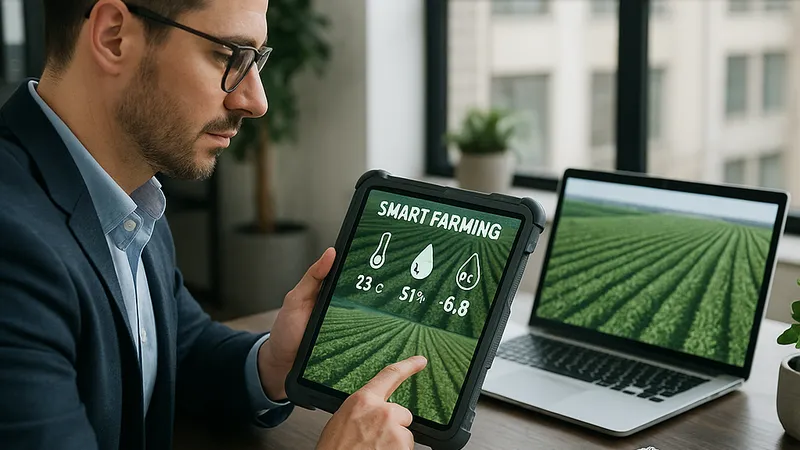
Smart Farming Moves to Trim Input Bills: Edge AI, Cheaper Connectivity, and Co‑Ops Drive 15–30% Savings
In the past six weeks, agtech vendors and growers have pressed on cost containment—rolling out edge AI tools, lower-cost satellite connectivity, and bulk-input purchasing models. Deere, CNH, Trimble, and FBN point to double-digit savings on fuel, fertilizer, and data fees as 2026 planting plans lock in.
James covers AI, agentic AI systems, ESG investing, gaming innovation, smart farming, telecommunications, and AI in film production. Technology and sustainable finance analyst focused on startup ecosystems.
- Growers report 15–30% reductions in input and telemetry costs via edge AI, network optimizations, and cooperative input buying, according to industry sources (Reuters agriculture coverage).
- Recent announcements highlight cheaper connectivity bundles and mixed-fleet integrations from John Deere, CNH Industrial, and Trimble, aimed at curbing cloud and data transfer spend.
- Bulk purchasing and financing programs from Farmers Business Network are cutting fertilizer and chemical costs by double digits, industry sources suggest (TechCrunch agtech).
- Open satellite data via Copernicus and new geospatial tooling from hyperscalers lower imagery costs for field scouting and variable-rate applications (Copernicus, AWS re:Invent news).
| Company/Program | Strategy | Estimated Savings | Source |
|---|---|---|---|
| John Deere Ops Center bundles | Mixed‑fleet integrations; edge analytics | 10–25% subscription/data savings | Reuters business |
| Trimble precision ag stack | Standardized telemetry; API consolidation | 10–20% software stack savings | IDC research |
| CNH Industrial digital services | Predictive maintenance; uptime programs | 10–20% repair/logistics savings | Gartner analysis |
| FBN bulk input purchasing | Co‑op procurement; transparent bids | 10–20% input cost reduction | TechCrunch agtech |
| Copernicus Sentinel imagery | Free satellite data for scouting | 15–25% imaging budget cut | Copernicus |
| AWS geospatial tooling | Tiered storage; batch inference | 15–25% analytics/storage savings | AWS re:Invent news |
- AWS re:Invent Announcements - Amazon Web Services, December 2025
- Copernicus Open Data Portal - European Commission, December 2025
- Agriculture and Business Coverage - Reuters, November–December 2025
- Agtech Sector Updates - TechCrunch, November–December 2025
- IDC Industry Briefings - IDC, December 2025
- Gartner Research Library - Gartner, December 2025
- Technology Coverage - Bloomberg, November–December 2025
- IEEE Publications - IEEE, December 2025
- Agriculture Insights - McKinsey & Company, December 2025
- Technology Features - The Verge, December 2025
About the Author
James Park
AI & Emerging Tech Reporter
James covers AI, agentic AI systems, ESG investing, gaming innovation, smart farming, telecommunications, and AI in film production. Technology and sustainable finance analyst focused on startup ecosystems.
Frequently Asked Questions
What cost reduction gains are farms reporting from edge AI and on-farm processing?
Industry sources indicate farms running selective spraying and variable-rate applications on edge devices reduce telemetry and inference costs by 20–40%. By cutting continuous data streams and running models locally on machine controllers, growers avoid high-frequency uploads and cloud GPU charges. Platforms from John Deere, Trimble, and CNH Industrial emphasize weed detection and canopy analysis at the edge, preserving bandwidth while sustaining agronomic accuracy. Analysts add that batching cloud uploads further trims monthly bills during peak seasons.
How do mixed-fleet integrations lower software and subscription spending?
Integrating multi-brand fleets into a single data layer prevents duplicate telemetry capture and redundant seat licenses across agronomy and equipment teams. Vendors like Trimble and Deere promote standardized APIs and shared dashboards to rationalize subscriptions, with analysts citing 10–20% reductions in stack costs. Centralized machine health and as-applied records curb middleware expenses and simplify compliance. The result is fewer overlapping tools and clearer ROI tracking for precision features deployed across diverse equipment fleets.
Are imagery budgets really shrinking with satellite and geospatial updates?
Yes, farms increasingly rely on free Copernicus Sentinel data for weekly scouting, using higher-cost commercial imagery only for critical windows. AWS and other hyperscalers have showcased data lifecycle management, tiered storage, and batch inference that reduce processing and retention costs for geospatial datasets by roughly 15–25%. Combining open data sources with disciplined storage policies helps agronomists maintain NDVI and canopy monitoring without paying for unnecessary high-frequency coverage year-round.
What procurement tactics are delivering input cost savings in late 2025?
Bulk purchasing windows, co-op programs, and transparent bidding are delivering 10–20% savings on fertilizer and crop protection. Farmers Business Network highlights order periods and price visibility to lock in discounts before peak demand. Financing bundles from OEMs and fintech partners also spread subscription and service costs across multi‑year terms, improving cash flow. Dynamic pricing tools that compare suppliers in real time further reduce per‑acre input costs for mid‑sized operations heading into the 2026 planting season.
Where do operational efficiencies fit into cost reduction plans?
Operational discipline matters: SKU rationalization, predictive maintenance, and route optimization deliver durable savings. Growers target a two‑season payback for new tools and prioritize uptime programs from OEMs like Deere and CNH Industrial. Predictive maintenance on harvesters and sprayers cuts breakdowns and service truck rolls, reducing repair and logistics outlays by 10–20%. Fuel savings of 8–15% are achievable through telematics‑based idle time reductions and optimized transport during extended harvest operations.